U.S. Geological Survey and Utah Department of Natural Resources Announce New Record Low Elevation at Great Salt Lake’s North Arm
Great Salt Lake Managed at Current Lake Level, through Comprehensive Management Plan
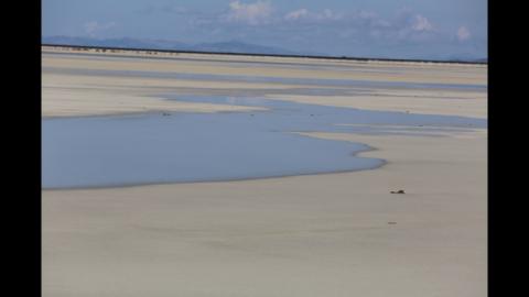
Salt Lake City (Dec. 29, 2015) – The north arm of the Great Salt Lake (GSL) has reached a new historic low. According to the U.S. Geological Survey (USGS) and the Utah Division of Forestry, Fire and State Lands (FFSL), the lake’s water level reached an elevation of 4,191.6 feet last month, one foot lower than the previous record. The low level has caused FFSL to exercise parts of the lake’s management plan ensuring the lake can continue fulfilling its economic and ecological roles.
At 4,192.5 feet, the south arm of the lake remains more than one foot higher than its previous historic low of 4,191.35 feet set in 1963.
“There is a chance the south arm of the Great Salt Lake could reach a historic low in 2016, but it depends on the amount of precipitation we get through the winter and spring months,” said USGS scientist Cory Angeroth. “The condition of the current mountain snowpack is definitely a positive for the lake and hopefully the storms will keep coming.”
For the first time since it opened in 1984, water has stopped flowing through the GSL’s Union Pacific Railroad Causeway breach. It was built by the State of Utah to assist with flood control by allowing water to travel between the southern and northern parts of the lake.
Water levels have dropped on both sides of the causeway, preventing flow from the south arm to the north and leaving the breach dry. Union Pacific has worked in partnership with FFSL
throughout 2015 and has permission from the state to construct a new bridge along the causeway to restore navigation and flow between the two arms. Construction started this fall.
“The health of the Great Salt Lake is important to the quality of life enjoyed in Utah. A healthy lake means thriving industry, which benefits the state’s economy,“ said Laura Ault, FFSL sovereign lands program manager. “A healthy lake also results in more abundant water resources upstream, flourishing wildlife, recreational opportunities, improved ecosystems and better air quality. We’re concerned about low lake levels because it can negatively impact the Wasatch Front’s overall health.”
The lake’s size and health is affected by the historic fluctuation of its elevation. As a result, the state’s approach to managing and protecting the lake must also be fluid and done in a way that maintains our quality of life. The FFSL manages the lake through a comprehensive management plan that adjusts and changes with the lake’s current level.
The Great Salt Lake Comprehensive Management Plan guides FFSL, along with local, state and federal partners, in managing, allocating and appropriately using the GSL’s sovereign land resources. Additionally, it outlines management goals, objectives and implementation strategies for guiding and directing future resource management actions, activities and recreational uses on the lake.
As the lake level has decreased in recent years, FFSL implemented management strategies to minimize adverse impacts to GSL resources and to further understand low lake level characteristics. Efforts included increased law enforcement on the lake bed; posting travel and off-highway vehicle closure notices along exposed areas to avoid impacts to nesting birds on Egg Island and increased research on how the exposed lake bed impacts regional air quality. Additionally, dredging of the Saltair Marina at Great Salt Lake State Park is scheduled to begin in the spring.
The USGS maintains a record of GSL elevations dating back to 1847 and has continuously measured the elevation of the lake since 1938. The USGS also conducts many studies on the hydrology, salinity, water quality and ecology of the lake. Learn more about the USGS studies on the GSL by visiting the USGS Utah Water Science Center website.
The Great Salt Lake Comprehensive Management Plan can be viewed or downloaded from the Division of Forestry, Fire and State Land’s website.